


Brownway Voting District, Horry County, South Carolina
About
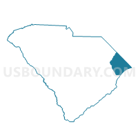
Outline

Summary
| Unique Area Identifier | 666120 |
| Name | Brownway Voting District |
| County | Horry County |
| State | South Carolina |
| Area (square miles) | 17.98 |
| Land Area (square miles) | 17.85 |
| Water Area (square miles) | 0.13 |
| % of Land Area | 99.25 |
| % of Water Area | 0.75 |
| Latitude of the Internal Point | 33.79239610 |
| Longtitude of the Internal Point | -79.17007180 |
Maps


Graphs
Select a template below for downloading or customizing gragh for Brownway Voting District, Horry County, South Carolina


Neighbors
Neighoring Voting District (by Name) Neighboring Voting District on the Map
- Britton's Neck Voting District, Marion County, SC
- Cedar Grove Voting District, Horry County, SC
- Jamestown Voting District, Horry County, SC
- Juniper Bay Voting District, Horry County, SC
- Pawley's Swamp Voting District, Horry County, SC
- Toddville Voting District, Horry County, SC
Top 10 Neighboring County Subdivision (by Population) Neighboring County Subdivision on the Map
Top 10 Neighboring Unified School District (by Population) Neighboring Unified School District on the Map
Top 10 Neighboring State Legislative District Lower Chamber (by Population) Neighboring State Legislative District Lower Chamber on the Map
Top 10 Neighboring State Legislative District Upper Chamber (by Population) Neighboring State Legislative District Upper Chamber on the Map
- State Senate District 33, SC (123,736)
- State Senate District 30, SC (89,291)
- State Senate District 32, SC (81,778)
Top 10 Neighboring 111th Congressional District (by Population) Neighboring 111th Congressional District on the Map
Top 10 Neighboring Census Tract (by Population) Neighboring Census Tract on the Map
- Census Tract 706.02, Horry County, SC (4,098)
- Census Tract 706.01, Horry County, SC (3,880)
- Census Tract 705, Horry County, SC (3,334)
- Census Tract 9508, Marion County, SC (2,369)